| |
|||||
|
A Closer Look: 'Mapping Global Cities' | ||||
|
|
|||||
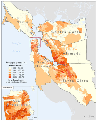
| The
map pictured above illustrates the percentage of foreign-born residents,
by U.S. Census tract, in six Bay Area counties. It is among more than
50 Geographic Information Systems (GIS)-generated maps featured in "Mapping
Global Cities: GIS Methods in Urban Analysis" (ESRI
Press),
a new textbook by Ayse Pamuk, associate professor of urban studies.
Pamuk, whose expertise covers housing, urban policy, international planning and research methods, uses this map to discuss "scale of analysis." Maps at different scales can reveal different levels of detail, she writes. For example, a map showing only the foreign-born population in San Francisco would overlook the many immigrant communities in the rest of the Bay Area. Pamuk's book is part of a National Science Foundation-funded project to introduce GIS -- which uses computer-generated maps to make comparisons and projections -- into urban studies and urban planning programs nationwide. It is a companion text to Professor of Urban Studies Richard LeGates' "Think Globally, Act Regionally," published in 2006. -- Matt
Itelson
|
|||||
 |
1600 Holloway Avenue, San Francisco, CA 94132 (415) 338-1111 |