Urban studies professor covers the waterfront
Nov. 9, 2011 -- Jasper Rubin has spent a lot of time around the real estate developers, government agencies and grassroots activists who hammer out the future of San Francisco. But the former city planner, now an assistant professor of urban studies and planning, believes that the past 60 years of development along the city's bayside waterfront is a unique story.
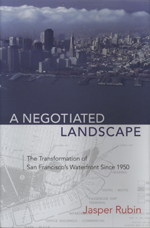
Rubin’s interest in the waterfront’s transformation from a deteriorating, state-managed shipping port in the 1950s to a city-managed, multi-use, open space in the new millennium began when he was a planner with the San Francisco Planning Department. Rubin chronicled the people, politics and events behind change in his new book, “A Negotiated Landscape: The Transformation of San Francisco’s Waterfront since 1950” (Center for American Places at Columbia College Chicago, distributed by University of Chicago Press, 2011).
“I was fascinated by all the invisible processes at play,” said Rubin, a Washington, D.C. native. “In the politics and policy involved -- the pressure from those at the top and the resistance from those at the bottom -- I saw how city planning could involve many different voices to develop a broader vision.”
According to Rubin, the port of San Francisco’s decline was in full swing in the 1950s after losing business to the larger Port of Oakland. Just as the state turned jurisdiction of the Port of San Francisco over to the city, officials considered major development along the waterfront flanking the Ferry Building. But proposals for high-rise housing and offices, the kind of development embraced by other waterfront cities at the time, drew objections from the emerging environmental movement and San Francisco residents who didn’t want their view of the San Francisco Bay to disappear. Legal wrangling, politics and crippling state and local regulations stymied change for about 25 years until the 1989 Loma Prieta earthquake destroyed the elevated freeway along the Embarcadero and introduced new options. Local activists sprung into action.
“Prop H, a citizen-based initiative, placed a moratorium on development of port property and required it to prepare a comprehensive land use plan that encouraged public and private partnerships,” said Rubin. “The restoration and revitalization of the Ferry Building is a good example of a successful partnership between business owners who wanted space on the waterfront and historic preservationists who wanted to preserve the building while meeting the requirements for public benefits, such as access to the water.”
Rubin notes that the fate of some of the port’s facilities north and south of the Ferry Building has yet to be determined, and plans to stage the next America’s Cup in San Francisco Bay have raised more concerns.
Though Rubin believes that the development of the San Francisco waterfront scores high in involving diverse interests, he still has concerns that high-end businesses, such as the upscale shops and restaurants that occupy the Ferry Building, could eventually dominate the Embarcadero.
“There’s something so visceral and evocative about being at the water’s edge,” Rubin said. “Everyone should have a stake in it.”
Share this story: